Want to unlock the power of geospatial data? Microsoft’s Planetary Computer Pro on Azure lets you build smarter AI applications! #Azure #GeospatialData #AI
Explanation in video
Hey everyone, John here! You know I love to break down the latest tech news, especially when it comes to AI and how it’s changing our world. Today, we’ve got something really neat from Microsoft that’s all about understanding our planet better using data. It’s called Planetary Computer Pro, and it builds on some amazing work they’ve been doing for science.
A smart scientist named Jim Gray once talked about a “fifth paradigm” of science – basically, using huge amounts of data and super-smart computer programs to discover new things. This idea is a big part of what we’re discussing today.
Lila: “John, you mentioned ‘machine learning’ when you talked about smart computer programs. That sounds like robots going to school! What is it really?”
John: “Haha, not quite like robots in a classroom, Lila! Think of machine learning as teaching computers to learn from data, a bit like how we learn from experience. Instead of giving the computer exact instructions for every single task, we feed it lots of examples (data). Over time, it starts to recognize patterns and can make decisions or predictions on its own. So, when we talk about using machine learning with Earth data, it means computers can help us find interesting patterns in all that information that we humans might miss.”
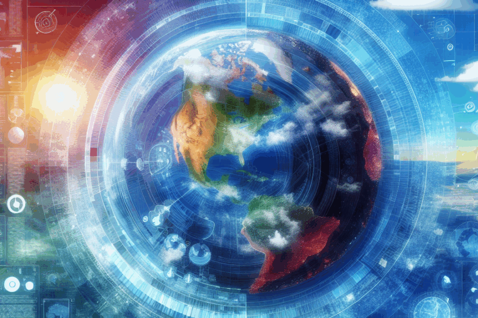
So, What’s All This “Geospatial Data” Fuss About?
You’re going to hear the term “geospatial data” a lot when we talk about this.
Lila: “John, I keep hearing ‘geospatial data.’ It sounds super technical! What does it actually mean?”
John: “Great question, Lila! It’s simpler than it sounds. ‘Geo’ means Earth, and ‘spatial’ relates to space or location. So, geospatial data is just any information that’s linked to a specific place on our planet. Think about things like:
- Satellite pictures of your town
- Maps showing roads, forests, or rivers
- Weather patterns for a particular city
- Information about where different types of animals live or where certain crops grow best
Imagine a pin on a map. Geospatial data is like that pin, but with tons of information attached to it about that exact spot. It’s data with an address!”
First, There Was the “Planetary Computer” for Scientists
Before Planetary Computer Pro, Microsoft created something called the Planetary Computer. This was like a giant, free digital library of Earth information specifically for scientists and researchers. It gave them access to incredible amounts of geospatial data – we’re talking satellite imagery going back decades, maps showing changes in forests or water bodies, population data, information about where wildfires have occurred, and so much more.
Lila: “The original article mentions ‘petabytes’ of data in this Planetary Computer. That sounds enormous! How big is a petabyte, really?”
John: “You’re right, Lila, it IS enormous! A petabyte (PB) is a massive unit of data. To give you an idea, if one digital song is about 5 megabytes (MB), one petabyte is like 200 million songs! Or, if you were watching high-definition video, a petabyte could store enough footage to play continuously for over 13 years. So, when they say the Planetary Computer has over 50 petabytes of data, they mean it holds an almost unimaginable amount of information about our Earth. Scientists could use this to study climate change, track deforestation, understand animal migrations, and test all sorts of ideas about our planet.”
Enter: Planetary Computer Pro – Earth Data for Businesses!
Microsoft realized that it wasn’t just scientists who could benefit from easily accessing and working with this kind of Earth-focused data. Businesses and other organizations could use it too! And that’s where Planetary Computer Pro comes in. It’s a new version, announced at Microsoft’s Build 2025 conference, designed for these enterprise users.
This “Pro” version is offered as a service within Microsoft Azure.
Lila: “John, you said it’s part of ‘Azure.’ I’ve heard that name, but what is it, exactly? Is it like a specific computer?”
John: “That’s a fantastic question, Lila! Think of Azure not as one single computer, but as Microsoft’s giant collection of online services. It’s like a massive, super-flexible digital toolkit that businesses can rent. They can use it for storing data, running applications, using AI, and much more, all without having to buy and manage their own physical servers and computer rooms. So, Planetary Computer Pro ‘lives’ and operates within this powerful Azure environment, making it easy for businesses already using Azure to tap into its capabilities.”
Okay, So What Can My Business Do With This “Pro” Version?
While the original Planetary Computer offers a vast catalog of existing data, Planetary Computer Pro is initially focused on helping businesses work with their own geospatial data. Imagine a company that manages large forests, or an agricultural business with many farms, or a city planning department. They all have their own specific location-based data.
With Planetary Computer Pro, they can:
- Bring in all their company-specific location data.
- Organize it efficiently.
- View it on interactive maps.
- Analyze it to find important patterns, make better decisions, or build new applications.
Microsoft sees three main groups of people who will find this super useful:
- Tech Wizards (Solution Developers): These are the folks who will build custom applications using all this Earth data. For example, an app to monitor crop health across hundreds of fields.
- Data Librarians (Data Managers): These people are responsible for organizing all the company’s geospatial data, making sure it’s accurate, secure, and that the right people can access it when they need it.
- Insight Seekers (Data Scientists): These are the detectives! They dive deep into the data, looking for hidden trends, valuable insights, and answers to complex questions that can help the business.
The Secret Sauce: What is STAC?
To make all this work smoothly, especially when dealing with data from potentially different sources, there’s a standard called STAC.
Lila: “The article mentions something called ‘STAC’ – SpatioTemporal Asset Catalog. That’s a mouthful! Is it important?”
John: “It absolutely is, Lila! And you’re right, it’s a bit of a tongue-twister. Think of STAC (SpatioTemporal Asset Catalog) like this: Imagine you have thousands of photos and maps of Earth, taken at different times, from different satellites or sensors, and stored in different ways. How would you possibly find the exact piece of information you need efficiently? STAC is like a super-organized, universal labeling system for all this geospatial data. It provides a standard, common way to describe each piece of data – what it is (e.g., a satellite image), where on Earth it’s for (its geographic coordinates), and when it was captured (the time aspect). Because it’s a standard, computers can easily search and find the right data, even if it comes from different places or systems. It’s like a universal library card catalog specifically for Earth observation information!”
A Peek Under the Hood: How Do You Use It (Simply Put)?
Getting started with Planetary Computer Pro involves a few key steps, but let’s keep it simple:
- Set up your “GeoCatalog”: This is like creating your own special, private section within the vast Azure cloud, dedicated to storing and managing your organization’s geospatial data. It’s your personal Earth-data library.
- Bring in your data: Your actual data files (like satellite images, drone photos, sensor readings) usually need to be stored in something called “Azure Blob Storage” first.
Lila: “Azure Blob Storage? That sounds… gooey! What on earth is that?”
John: “Haha, ‘gooey’ is a funny way to put it, Lila! ‘Blob’ in this case actually stands for Binary Large Object. But you can think of Azure Blob Storage simply as giant digital storage boxes that Microsoft provides in its Azure cloud. You can put almost any kind of digital file in them – images, videos, documents, sound files, and yes, all that geospatial data we’ve been talking about. It’s super handy for storing massive amounts of information that doesn’t necessarily fit into neat traditional database tables, like rows and columns.”
- Add details (Metadata): Once your data is in Blob Storage, you tell your GeoCatalog about it. This often involves using a popular coding language called Python (it’s widely used for data work because it’s powerful yet relatively easy to learn) and STAC principles to describe your data – what it is, where it’s from, when it was captured, etc. This “data about your data” is called metadata, and it’s what makes your data searchable and usable.
- Explore and Analyze: Planetary Computer Pro provides tools, including a built-in “Explorer,” that let you see your data layered on a map. You can then start to analyze it, combine it with other information, and build applications.
And if you have tons of data to add, there are ways to do “bulk ingestion” to load it all in more efficiently.
Lila: “John, the article says you can use ‘APIs’ to start using the data in your own applications. What’s an API?”
John: “Good one, Lila! API stands for Application Programming Interface. It sounds complicated, but it’s basically like a special menu or a set of rules that one computer program provides so other computer programs can ‘talk’ to it and request services or data. Imagine you want your custom-built farm management app to show a map with some specific soil data that’s stored in Planetary Computer Pro. The API is the set of instructions and tools that lets your app communicate with Planetary Computer Pro, ask for that soil data for a specific area, and then display it correctly on the map within your app. It’s how different software pieces connect and work together smoothly without needing to know all the messy details of how the other piece works internally.”
Making it Real: How Could This Be Used?
This all sounds very technical, but the real magic is in what you can *do* with it. Here are a couple of examples:
- Supercharging “Digital Twins”:
Lila: “John, the article mentions ‘Digital Twins.’ It sounds like something from a sci-fi movie, maybe like a computer game character that’s a copy of a real person!”
John: “That’s a cool way to think about it, Lila, and not too far off! A Digital Twin is basically a virtual copy, a dynamic computer model, of a real-world physical object, place, process, or system. For example, a company could create a digital twin of its factory to monitor operations, or a city could have a digital twin of its traffic system to test new light timings. With Planetary Computer Pro, you could add rich, real-world geospatial and environmental data to these digital twins. Imagine a wind farm’s digital twin not just showing the turbines, but also incorporating real-time wind patterns from weather data, the terrain of the land from elevation maps, and even historical satellite imagery to see how nearby vegetation has changed. This makes the digital twin much more accurate and powerful for testing ‘what if’ scenarios, predicting performance, and optimizing the real-world version without costly physical trial-and-error.”
- Smarter Farming (Precision Agriculture): Farmers can combine their own data (like soil sample results from their fields, or data from sensors on their tractors) with broader geospatial information available through tools like this (e.g., historical weather patterns for their specific area, satellite images showing plant health across the region). This can help them make much more precise decisions about when and where to plant, irrigate, or fertilize, leading to better yields, lower costs, and less environmental impact. They could even use their own drone photography and process it here!
- Understanding Our Environment: Companies and researchers can use it to track changes in forests over time, monitor coastal erosion, understand how urban areas are growing, or see the long-term impact of climate change on specific regions.
Why Does All This Matter?
Too often, we think of the systems we build – our businesses, our cities, our infrastructure – as separate from the planet they exist on. But we’re learning more and more that everything is connected. Tools like Planetary Computer Pro are important because they help us see and understand those connections much more clearly.
By easily working with geospatial data, organizations can:
- Make their operations more efficient.
- Reduce their harmful impacts on the environment.
- Better predict and respond to environmental changes.
- Develop more sustainable practices.
It’s about using technology to add a new layer of intelligence to how we interact with the broader environment, making us better stewards of our world.
A Few Thoughts from Us…
John: For me, this is really exciting. It’s like we’re finally getting the tools to truly understand the complex dance between human activities and the natural world. It’s not just about cool maps; it’s about making genuinely better decisions for our businesses and our planet. The potential here to manage resources more wisely and build more sustainably is huge.
Lila: As someone new to all this, it still sounds a bit like magic! But I get the main idea: using smart tech to look at Earth information in new ways. If it can help businesses be kinder to the planet while still doing their work, that sounds like a win-win to me. I’m curious to see what kinds of innovative things people will build with this!
This article is based on the following original source, summarized from the author’s perspective:
Use geospatial data in Azure with Planetary Computer
Pro